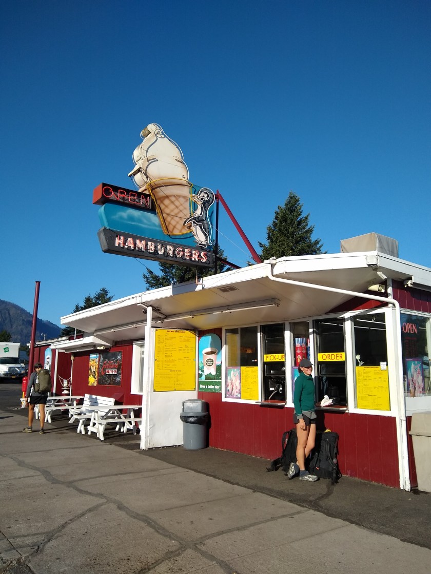
The final miles are the worst when you’re looking forward to getting into town. We don’t stop often on these runs and this stretch was the longest we’d done, nineteen miles southbound into Cascade Locks.
Town feels next door when you set out at first light on that morning before beer and cheeseburgers. You wake, stir your throbbing feet alive in your quilt and struggle to stretch to touch your toes as you chew into first breakfast. Everyone is buzzing a little about the prospect of food, and food and more food.
Once the initial adrenaline boost dies down, our destination seems to get further away the closer we get. It’s getting hotter and our feet are barking at us like rabid hounds. The 2000 foot climb just to go down 3500 into town seems utterly pointless at times like these. A moment of hiking, staring at scrolling rocks like a manic computer game can be blissful meditation, but today it was all encompassing pain.
We had done this section relatively quickly, keeping up with the hiking machines that flipped from the desert and breaking our own mileage records. We saw hikers we assumed were days ahead. We felt good about our progress and our ability to keep up with the younguns.
But our feet were beaten and bruised. Trail discomfort is something akin to a state of permanent fleeting pain. It might be your heel for five seconds, your achilles for three days or a shin for six weeks: you’re always dealing with some issue that could make you stronger or equally knock you off the trail if you don’t tend to it. Jen calls it “walking the tightrope between adrenaline and injury”.
Due to this increased focus on our bodies and miles, we have struggled to post on the blog. We just haven’t had the time. We’ve gone from 8-12 mile days in the Olympic National Park to 20-27 mile days in the past couple of weeks on the PCT.
In the past seven days we have hiked over 150 miles and in the last two days alone we completed two marathons. This leaves less time for other things as practically every waking moment is focused on walking or preparing for walking.
This focus is necessary though and needs to continue in Oregon as we move towards a comfortable experience in the Sierras, a place we have both hiked before and have no desire to experience in freezing dangerous conditions that are common in October.
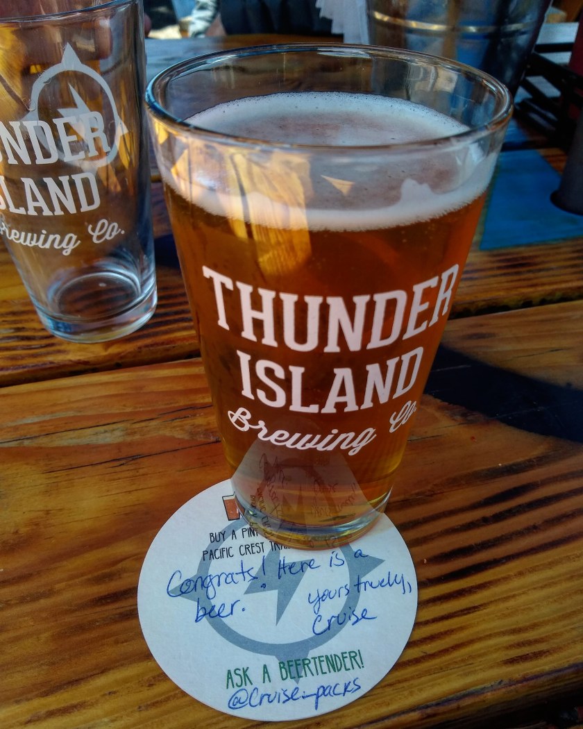
Yet we can’t only look to the future too much now, or focus on the pain either. We must enjoy the present, especially this cider that I have in my hand, a breakfast burrito I’ll have tomorrow, a burger and PBR I just had, biscuits and gravy I ate this morning, the free beer that’s coming this afternoon, the showers over there and every other joy town brings.
This is our day off walking and we will enjoy it. A lot. Miles and rocks can wait for tomorrow. Pain takes a back seat for a few days after these trips.
I was half awake at 2am in our camp at Susan Jane Lake aside a retreating bolder covered mountainside that towered a thousand feet above us. Two leaves brushed along the tent fly making semicircular sillouetes for me to stare at while my thoughts went round my head of the days ahead. Everything else in the valley was dead still. Suddenly out of that ocean of stillness came a rapidly approaching rumble.
We had walked out of town after two wonderfully relaxing days of sausage and cider with Jen’s parents in Leavenworth. It was time to get serious with some real hiking in this 70-mile section from Stevens Pass to Snoqualmie. We have to move now, we should be doing 20+ mile days every day till November to make it before the snow comes. My feet hurt just thinking about it.
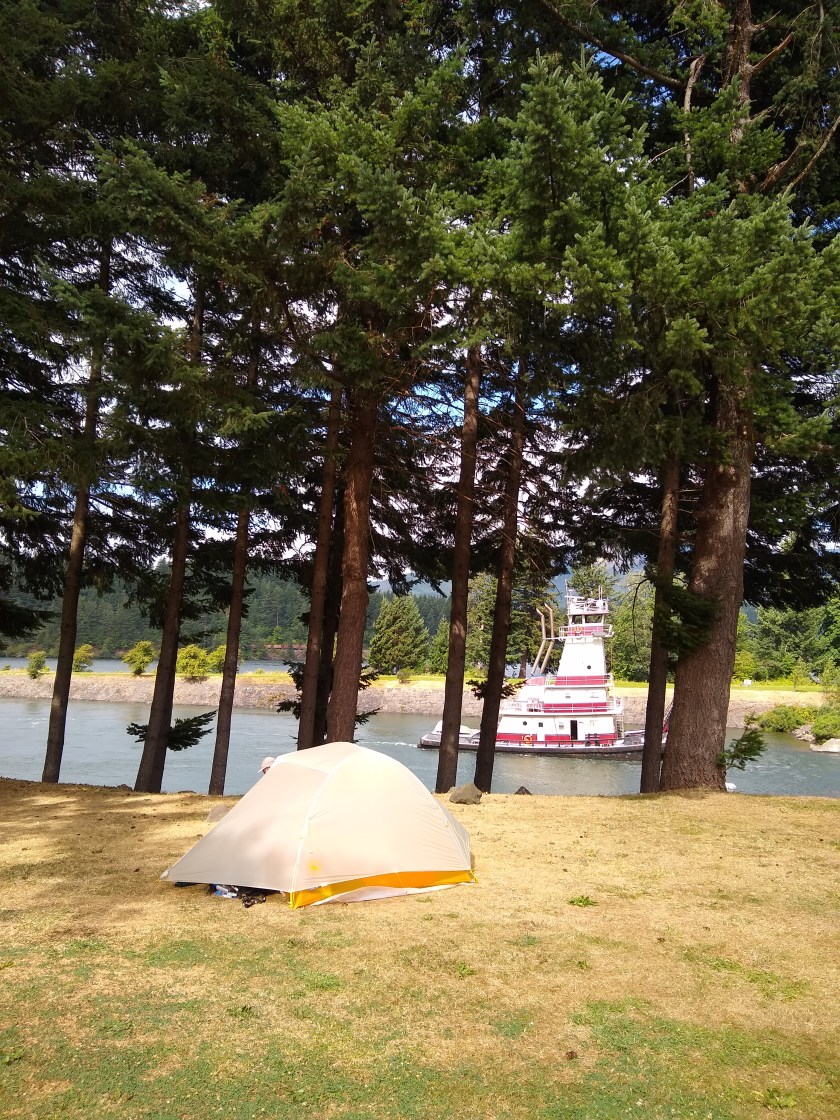
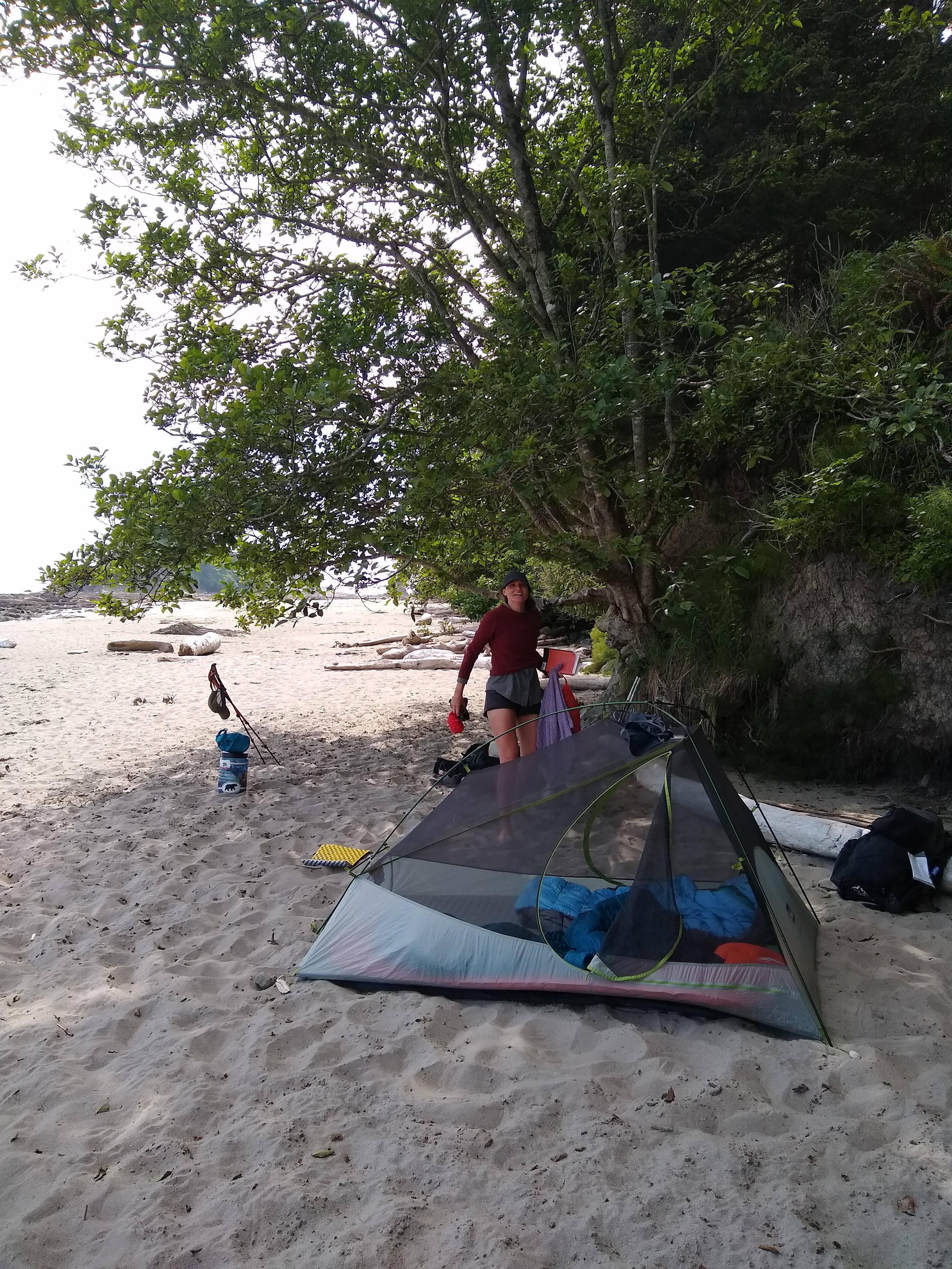
Our campsite
The problem that day was we left late and weren’t far from civilisation when we decided to camp early due to post-zero day laziness, sore knees and a even sorer Washington apple filled head.
As listened to the rumble I wondered if it was truck shifting down gears on the highway we had crossed earlier and remembered living close to large avenues in Mexico City. But there was a whole mountain between us and the highway. Maybe it was a plane?
I started to slip off to sleep again and as I drifted off I heard the same sound again in the distance. This time it was deeper and louder. It came from the west with a dull but rapidly increasing rumble, then the sound got louder and closer, then sharper as rocks shifted on our valley’s walls.
The adrenaline started surging. We were having an earthquake. My body always reacts faster than my own realisation of what’s going on. After experiencing being in large quakes, your body takes over in future situations. Not much time for rational thought, just enjoy the rush and hope you’re in the right spot.
I heard bolders shift, crack and clack together close to us across the water and at the very same time the floor jolted up. My sleeping pad amplified the wave.
Then it was gone even faster than it came and again it was just me again in my rational thought but with my eyes wide, pressed against my pad and the feeling of four espressos inside.
We found out later that it was a 4.8 and close to the trail. It was the talk of the trail the next morning.
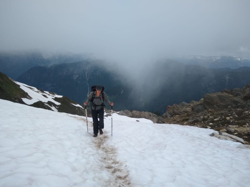
Jake crossing a dangerous snow bank earlier in the trail.
“Yoohoo!”
We heard a voice — very faintly. It seemed so far away — maybe on the other side of the valley. We couldn’t tell how far. Jake and I stood frozen.
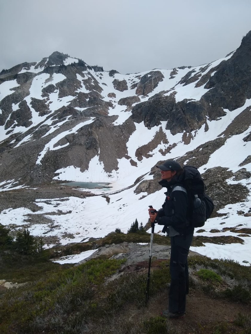
We were at the top of Red Pass in the Glacier Peak Wilderness, smack in the middle of what we were told was “the hardest section of the PCT.” We were less than two weeks into the trail, still nursing constant aches and pains. Each little twinge threatened serious injuries like plantar fasciitis or shin splints, but many of which healed after a good night’s sleep or a diligent stretch in the morning.
That day had been punishing. Dense, bone-chilling fog descended on us as we made our way up seemingly endless switchbacks to a mountain pass. After living in Mexico City, I used to scoff at any peak or pass under 12000 feet. But that day, a 6300-foot pass was killing me.
A brief moment of lightness in the fog
Finally we rounded the last bend and wrenched our wrecked hamstrings up onto Red Pass. I nearly collapsed into a puddle, knowing that wasn’t even the last pass we would need to cross that day. It was barely noon.
We emptied our food bags and began to assemble our lunch of tuna and tortillas. While doing so, we chatted with another hiker who had breezed past us on the uphill. She had hiked the Appalachian Trail the year before and had impressed us with her light pack and carefully chosen gear. After telling us a bit about her story, the hiker moved on. Jake and I both commented that she seemed to be such a strong walker, she would probably be days ahead by the time we made it to the next trailhead at Stevens Pass. We were then quickly distracted by a friendly marmot who ran into the pass, only vaguely afraid of hikers.
The marmot atop Red Pass
Then we heard the shout.
“Jen, be quiet,” Jake whispered. “I think I heard someone.”
We waited, but heard nothing. I was cold on the pass so I packed up my trekking poles and buried my hands in my pockets. We hoisted on our backpacks and started down the pass.
After 20 feet, we heard the voice again. It was the same hiker who we had been chatting with moments before. Then we saw her.
She was perched in the middle of a snow bank, hanging on to her trekking pole.
“I slipped,” she called to us. “I’m stuck.”
Jake and I ran over to her.
Ever since we arrived in Washington, we we heard about the north-facing slopes of the Cascade Mountains. Less sun and more exposure meant those hillsides were more likely to have snow. This year, the snow melt was early in the Cascades— we were able to start our hike a few weeks earlier than we expected. For the most part the snow has melted, but it still remains in sections, especially on those northern slopes. Most of the time, it is quite slushy and there are clear footprints showing the way through. But sometimes the snow is steep and drops off at a sharp angle. For those moments, we carry micro spikes. Micro spikes are like crampons but a little bit lighter and a little bit less grippy.
The snow in Glacier Peak Wilderness has melted significantly but hangs on in sections.
As we approached the hiker in the snow bank, we saw a trail of footprints. They rose a few feet above the track of the PCT, which was still covered in two inches of ice. Those footprints told us exactly what had happened. Just three steps across the snow field, one footprint skidded down at a chilling angle. Ten feet below was the hiker. She was stuck on the side of the trail, unable to move from her spot. Below her were several hundred feet of slick snow. The bank was so steep at that point, she was wedged up against the icy track of the PCT. She had managed to reach her micro spikes, but her position was so precarious she couldn’t put them on. And she was too far into the snow field to crawl out.
Hurriedly Jake pulled on his own spikes and rushed over. Before he could reach her, he had to knock ice off the trail first. He slammed his trekking poles into the mud, slinging chunks of ice as he went. Meanwhile the hiker hung on, worried any movement would sent her skidding down the bank.
After several nerve wracking moments, Jake was able to reach her, grab her backpack and pass it over to me. At that point I had my micro spikes on as well, but the ledge Jake was working on was so narrow and mucky, he told me to stay where I was in the muddy — not snowy — section of the trail.
Jake inched closer to the hiker, hacking through slush and ice. When he finally reached her, she was able to shimmy sideways. He grabbed her arm to hoist her up onto the spot he had just cleared of ice, first, in a sitting position and then to her feet. We asked how she was. “Cold,” she told us, “covered in mud, but otherwise fine.”
We took a few moments to collect our thoughts, but there was little time to rest. We still had to cross the same snow drift she had just slipped on.
Crossing a snow field
All three of us in micro spikes venture up along the trail of footprints. Jake went first, kicking in steps as he went along. The hiker went next. I followed after her. With Jake’s steps, the micro spikes and my trekking poles, I felt very secure on the snow. We reached the other side, and the hiker doubled over in visible relief. I felt tears tugging at the corners of my eyes in my own relief for her and us.
We removed our micro spikes and took stock. Suddenly the dense fog that had blanketed us all day parted. I won’t say there were blue skies, but the lightest hint of blue could be seen above the clouds. And finally we saw the view: lush green mountain slopes ahead. We continued hiking, the three of us in a row, as the marmots cheered us on with their high pitched chirps (marmot-call). Eventually, the hiker passed us and went on ahead to camp. We only saw her once after that. She’s probably a day or so ahead of us by now.
**I left the hiker’s trail name out of this post.**
Tomorrow morning we head off to Hart’s Pass to start the PCT SOBO.
Jen’s parents have been wonderful hosts and have gone out of their way to help us get ready for this hike. They’ve filled us with pizza and Snowgoose icecream, taken us to Costco and much much much more. Thank you.
We’ve spent the last four days post-shakedown hike mixing the mad purchase and preparation of gear and food/resupply boxes with relaxation with Jen’s family and friends on Samish Island, WA. It’s a beautiful little spot on the Puget Sound right on the Pacific Northwest Trail (the PNT) near Anacortes and I had the highest honor of attending the event of the century at the Samish Island mass garage sale as well as a delicious spaghetti dinner cooked by a family friend Jan yesterday. Delicious.
Much of the last couple of days has been spent repackaging an assortment of meals and snacks into the first five stages of the trail: Harts to Stehekin, then to Steven’s, then Snoqualmie, then White. We will be sending these packages to ourselves at post offices and hotels down the trail for the first 30 days or so. After that, we’ll see.
There’s not a great deal of choice in these places and we’d rather have a decent food selection than scraping by on Sour Patch Kids. I’d never done this so thoroughly before, so it was a good learning experience and one we don’t think we could have done without doing our 12 day jaunt in the Olympic National Park first. We hope our food is varied enough we won’t want to throw it into the nearest hiker box.
Our food for the first month.
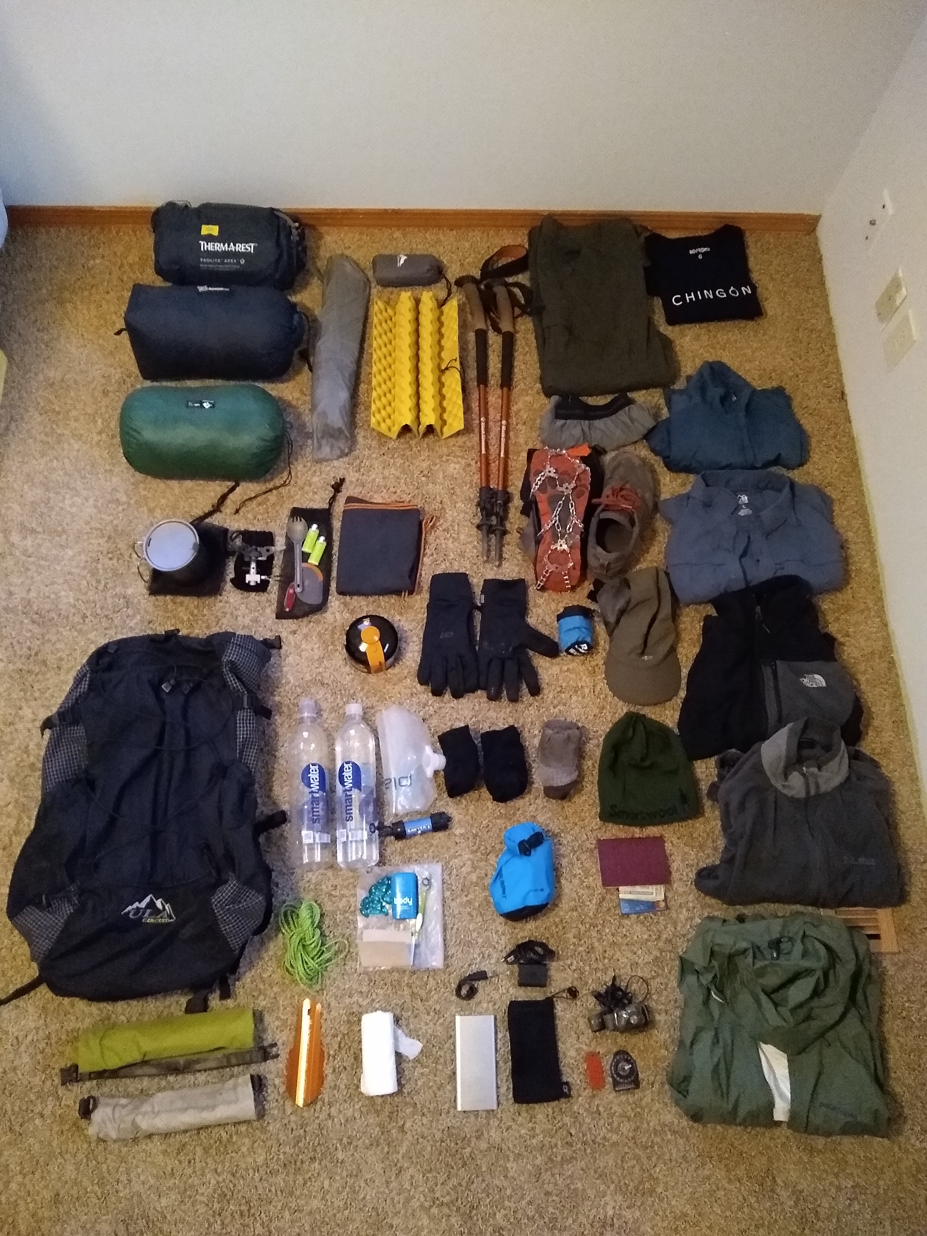
This evening it was great to see all my gear for the PCT all in one place at one time. This is the first time it’s happened as on our Olympic National Park hike I had most everything I do now, but I’ve since made a few tweaks and added in some clothing especially as it’s forecast to have highs in the low 30s (around 0*C) and a few days of snow in the next week where we’re heading. Then we have my birthday in Stehekin in 85* sunshine. Perfect.
It’s so nice to not have a bear canister anymore as I was lugging that 3lb bad boy around for almost two weeks. That weight’s gone, but now I have a set of Hillsound Crampons Ultra that I’m pretty excited about. Even though it’s almost a pound of weight, they’re super comfortable and seem really sturdy and should help out quite a bit on the icy sections we have coming.
I’m not sure what my base weight is because honestly I couldn’t care less about the exact number, just as long as I’m lighter than the AT and I know I am. I just go lightweight and don’t fret about it too much. I might ask the post office worker tomorrow to let me throw it on the scale and see where I’m at. I know I could drop my cotton camp shirt and a couple little bits here and there, but for now, I’m just fine and my backpack packs down small even with 4 days of food in. Let’s do this!
My gear. You can see it in detail above on the “gear” link on this site
Once I got to Seattle I was glad to hang out with a good friend there I know from Mexico City for a few hours. He hooked me up with a place to crash as I got in so late. We visited REI the next morning and got some great biscuits and gravy at Five Points Cafe. After a stroll down 3rd that made the Denver addicts look like amateurs, I said cheerio to Grant and headed off to Amtrak to meet Jen and her mum on their way back from Portland.
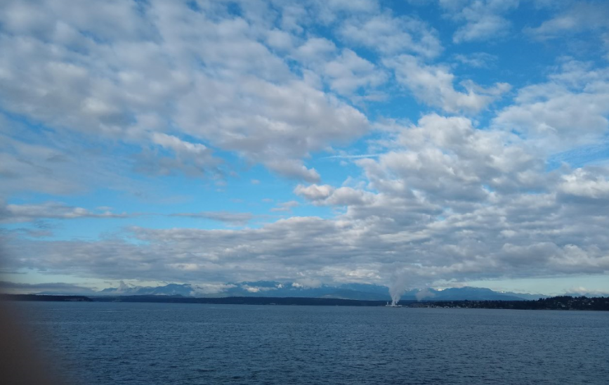
Once we got to Samish Island, we spent the evening eating, catching up chatting planning and packing before our short night’s sleep. The next morning we took a ferry to Port Townsend. It was a short trip across the water but we could see the mountains of the Olympic National Park across the way and suddenly everything felt quite real. This adventure was actually going to happen!
View from the ferry to the Olympic Peninsular
Arriving at the WIC, PA
We spent the next several hours traveling bus to bus along the northern Olympic coast, stopping via the Wilderness Information Center and got our passes and information from ranger Brenden.
As soon as we arrived in Neah Bay, a guy from the Makah Reservation stopped in his pickup and offered us a lift without us even sticking out our thumbs. We jumped in the back and he drove down the dusty road that diverted us around a small forest fire, stopping at key spots so we could take shots of the beaches an stacks from his pickup. He dropped us off at the Shi Shi beach trailhead (pronounced Shy Shy) seemingly pretty excited about the fact that I was English shouting to some other hikers “He’s English!” and in return the Russians shouted less enthusiastically that they were Russian.
Our first hitch this summer from the pickup
We set up our tent on Shi Shi beach and we contemplated our coastal adventure of about 50 miles ahead, struggling to cook efficiently, being disorganized with our gear and feeling a bit untested in the outdoors. That’s what this trip was for though – let’s fudge this up and learn from it for the PCT.
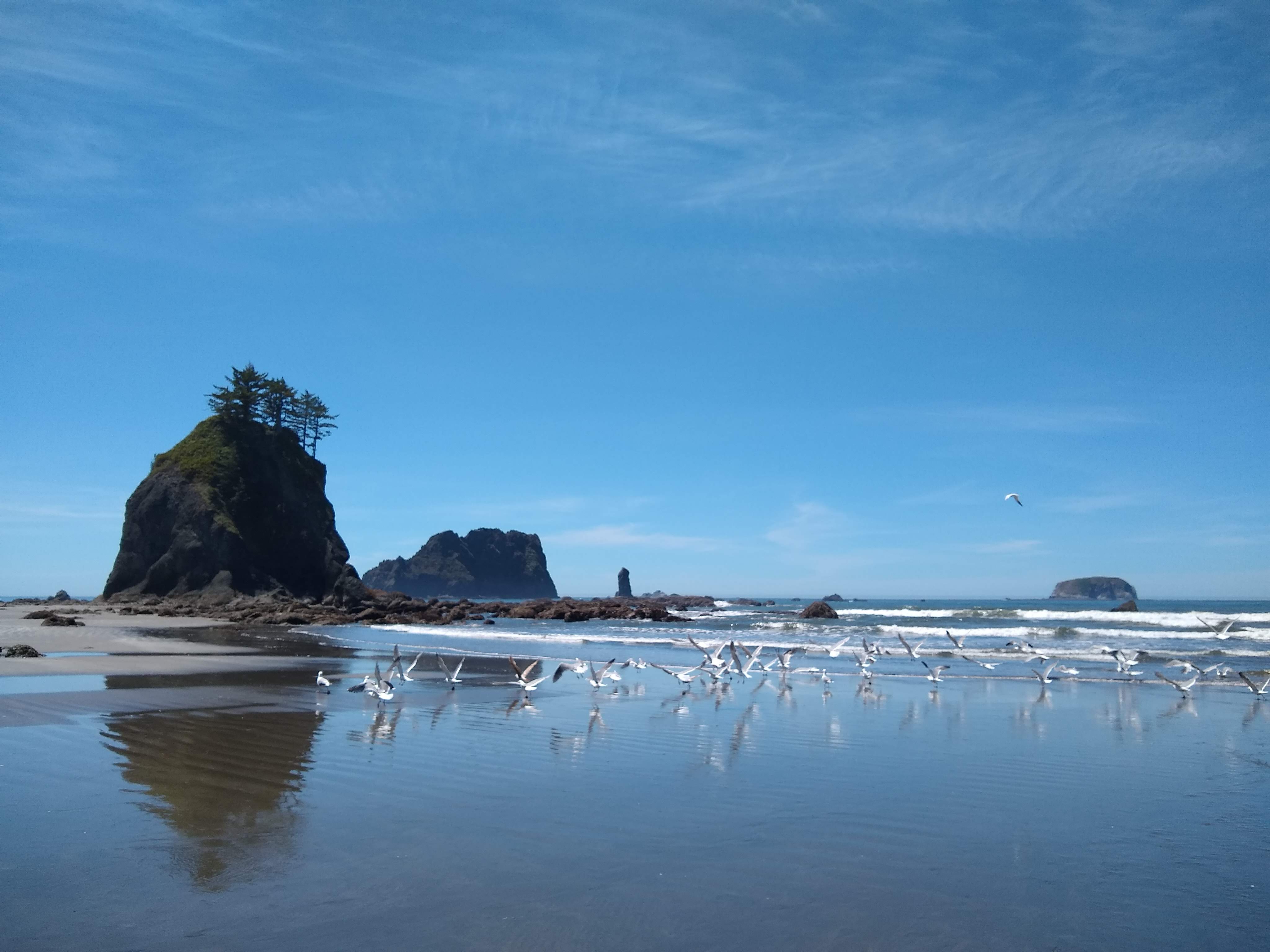
Walking along Shi Shi
We settled down as a misty haze rolled in and the sun turned it a dark yellow during sunset. The next day we woke up to an overcast sky that burnt off in a couple of hours and glorious sunshine and beautiful views across the beaches came through. The forecast was basically the same for the next five days: glorious and hot. We looked at our maps and studied the tidetables for the 14th time and decided we had a nice relaxing 8 miles to our next campsite North of Ozette.
We headed off down Shi Shi and hit our first headland with ropes up the side of slopes way too dangerous to climb without this helping hand. We ascended and descended about three of these immense challenges on the first day. The last being the steepest and craziest, jumping off into a new environment. We settled down, feet and body sore and realized this wasn’t going to be a cake walk in the sun we had naively figured.
Jen dragging herself up a headland
The pattern of challenging but really enjoyable and fun days continued with gorgeous sunshine, making this normally wet and grey coast into something that could easily rival Mexico for beach beauty. Each part of the coast is distinct from the last: hard climbs over headlands using ropes, ups and downs to rival any part of the Appalachian Trail, hopping from seaweed covered rock to seaweed covered rock, soft gravel beaches where each step felt like three and easy hard yellow sand where you had to find the sweet spot of give and sink – just above the peak reach of the last wave.
The northern coast Wilderness Trail was hard, really hard at times. We successfully spent 24 days on vacation of beer and food and sightseeing and now my arse was getting kicked by the trail. My swollen Achilles kept badgering me but I was getting it under control with stretches and clearly I didn’t bring enough snacks.
Rocks and more rocks
We took it slow, getting used to the daily routine and doing each step slowly. Walking to get water and filtering it at a painfully slow rate. Washing up and not quite hitting the mark, doing it again. Trying to light a fire and having to start again. Each time things got a little easier and we laughed at our amateurish selves just hours before. Each day got more comfortable and our mileage increased a little. We started at around 8 miles a day and that increased steadily.
Maps and tidetables
Camping on Caribbeanesque sands
The Wilderness Coast is wild and has zero development. I hiked alongside a deer for a while, thousands of crabs dart away as we progressed, an otter came to see us at a water source before diving in two yards away, seals played in the waves next to the shore and we saw at least 50 eagles perching atop of trees and fishing in the ocean. There was even, unfortunately, a washed up and very bloated stinky whale on one beach that looked like it might explode. We had planned on camping right there, so carried on down wind not quite enjoying the aroma.
Further down the coast, we picked up a hitch from the very lovely Maureen and Kate who took us to a store and waited patiently for us before taking us to our trail head. Eventually reaching the end of our line at the Hoh Indian Reservation, after a grey and rainy day before, we were very ready for our motel room and cheeseburgers in Forks.
The next day, resupplied and laundered, we headed back to the trail, this time to the valleys and rainforests of the centre of the park.
We headed from Villahermosa towards Coatzacoalcos, Tabasco. Another veritable crater of a town; it flickered in the light of huge flames sprouting above the refinery towers. I swore it looked like a desert, at least that’s the memory I chose for it. Iraq circa 2005 is what saw followed by concrete bridges.
The pharmacy acquired helping hand kicked in and took us over the clouds to Oaxaca city via every other city on route first. What a beautifully uneventful journey with the promise of a tlayuda at the end. Mexican buses are like Greyhound with a much smaller chance of being murdered on and bigger seats and more respectable stations.
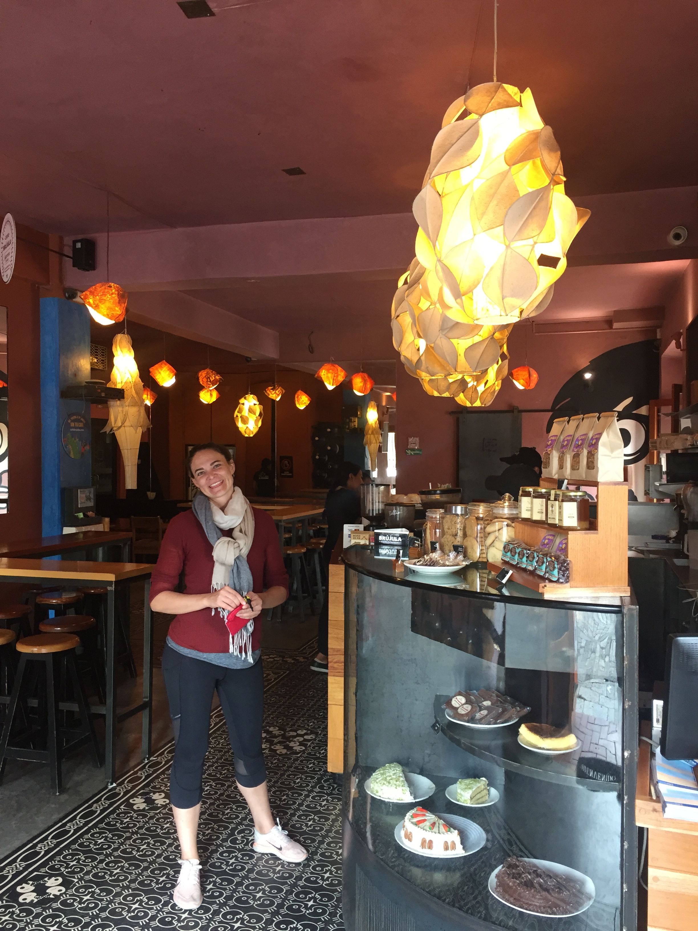
We got into to Oaxaca and headed for coffee in La Brujula Cafe then on to the market for meat and mezcal. We went to the hottest spot for Mezcal in Oaxaca City in the market and talked to the lady about different mezcales, sampling lots and ultimately going for some sweet hand written label madrecuish mezcal for our coming days in the mountains and at the beach. I think that will be one of the things I’ll most miss about Mexico – this stage of the trip to the Oaxacan coast.
La Brujula Cafe
Buying mezcal
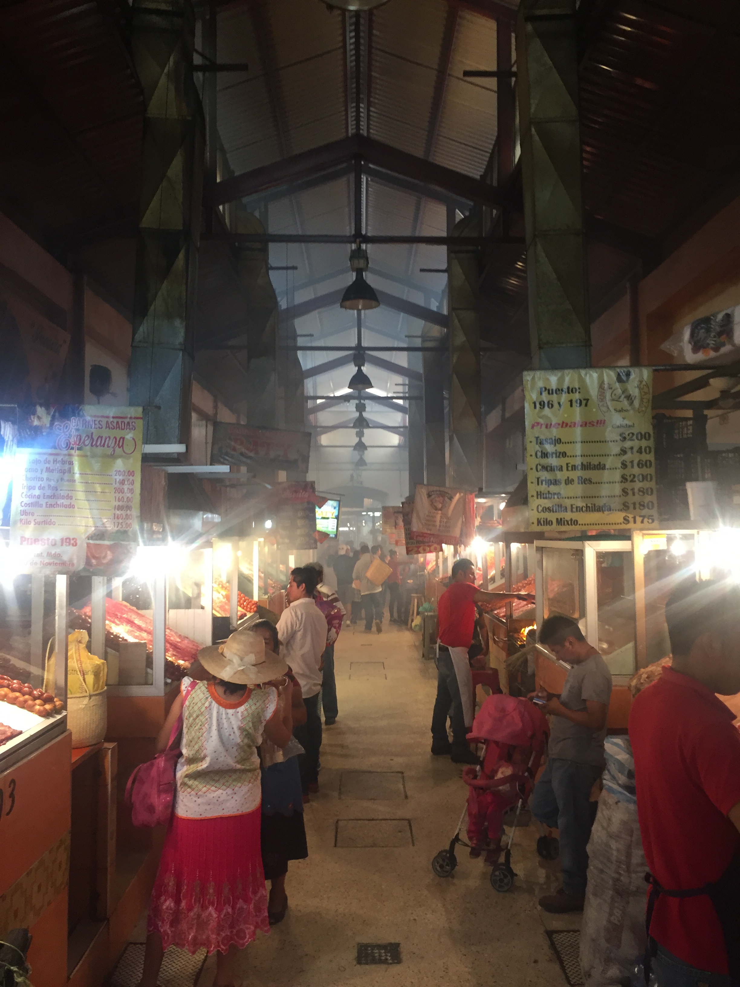
We ate meat and made friends at the end of the long meat alley. You choose your meat combo from an array of sellers. They grilled up our chosen meat as we grabbed salsas and tortillas. (God bless the Oaxacan tortila).
I call this meat alley
When we meet people, we always tell people where we’re from: Jen from Washington, USA (“oh”) and me from England (“ooh”). We were talking the previous day about the Mexico experience being a little easier when you’re from England so I decided to tell these guys “yeah we’re from England” as a little joke for Jen to see the more positive reactions one receives.
Turned out one of them was a journalist, Jaime López Cosme (in the red shirt next to me) and he wrote a short interest article about us on a local news website Esta Mañana. He took a shot of us but we had also taken some group photos so didn’t think much about it. Now that little half truth about us both being English has created some semi-fake news. sad! Check out our article!
We then headed over to the bus station to grab our backpacks and skipped on down to get a mini bus up into the mountains to the next stage of our adventure, San Jose del Pacifico. It was a long hot ride for about 3 hours which ended in the clouds and checking into our cabin overlooking the long deep valleys of the Sierra Madre.
San Jose del Pacifico is a funny little town that is known as being a kind of rural Amsterdam in the mountains. We figured we would do a decent hike to the next town over but in the end we left a little earlier so we could get to the beach. We took part in a temezcal sweatlodge and watched the last episode of Game of Thrones. Ate some tlayudas.
Villahermosa is weird and hot. It doesn’t sell beer near the town hall because it’s full of alchoholics and that might put off the occasional tourist. Clearly well past its best, it’s like a hot Cuatro Caminos with a sweaty death river reflecting its way across the map on our wrong side of town. There’s a “video bar” under our hotel whatever that is, what it does mean, however, is that clearly the only guests in the place are positioned on the 4th floor instead of the first to avoid the beat. It was also about 110*. I hated the first couple of hours in Villahermosa. Mixed clothing only sauna.
Villahermosa, however also has the best seafood ever, is cool in the morning with pozol de cacao and has a couple of charming alleys with cinco de mayo trees. There’s a deeply buried charm to it that only an eternal semi-optimist would be able to find. I hated it the day we arrived and felt a light guilt the next day. La Cervicheria de Tabasco is supreme. We stumbled in to the air conditioned dining local and were seated and served in seconds. This place is next level and we’ll forget the shit about VIllahermosa and remember this plate of food instead:
the ceviche
Either way, it wasn’t worth staying. But it was worth eating. We wanted to go back the next day, though it turned out we didn’t have the time. We were heading to the Pueblo Magico in Tabasco, Tapijulapa /tap-ee-who-LA-pah/. It was worth it even though it seems the government of Tabasco doesn’t want you to visit it. We managed to spend about four hours there and saw the confluence of two rivers, bathed in its sulfurous waters, hiked in 110* heat,visited a beautiful mansion and didn’t quite have enough time for lunch. We hiked, I felt strong in 100* but there was no pack.
After our experience switching off from work in San Cristobal, we moved on to a more active section of our trip with promises of jungle hikes to get us a little practice (!) for our coming PCT thru hike. Hiking has taken somewhat of a back seat the past couple of weeks though we can still feel our recent efforts below our vacation butts.
We took off to Palenque the really really long way round but via smooth sailing roads on a comfortable bus for 8 hours through two scruffy cities, Tuxla Gutierrez and Villahermosa to hit the jungle town of Palenque by mid afternoon. There was another couple who also had clearly not researched the length of the journey like us. They turned out to be a newly married couple Becca and Jam from Oz. We ate pizza and drank mezcal with them later and got some ideas for our coming days in Oaxaca.
Our cabin was in the jungle, on the edge of the ruins of the ancient Mayan city Palenque. I stayed here a decade ago and was glad to see very little had changed since then. Still the rustic, sweaty hippie hang out in the trees with 2×1 cocktails all afternoon, pizzas and the smell of the Californian’s smoke next door. It was 101* and everything was dripping in permasweat.
As we settled down for a good sleep the first night, we heard howler monkeys screaming in the canopy. Imagine an dinosaur who’s irritated with a neighbour and you’d have some idea of what they sound like. A pretty haunting sound and a loud one too.
What was once a building on our improvised jungle tour
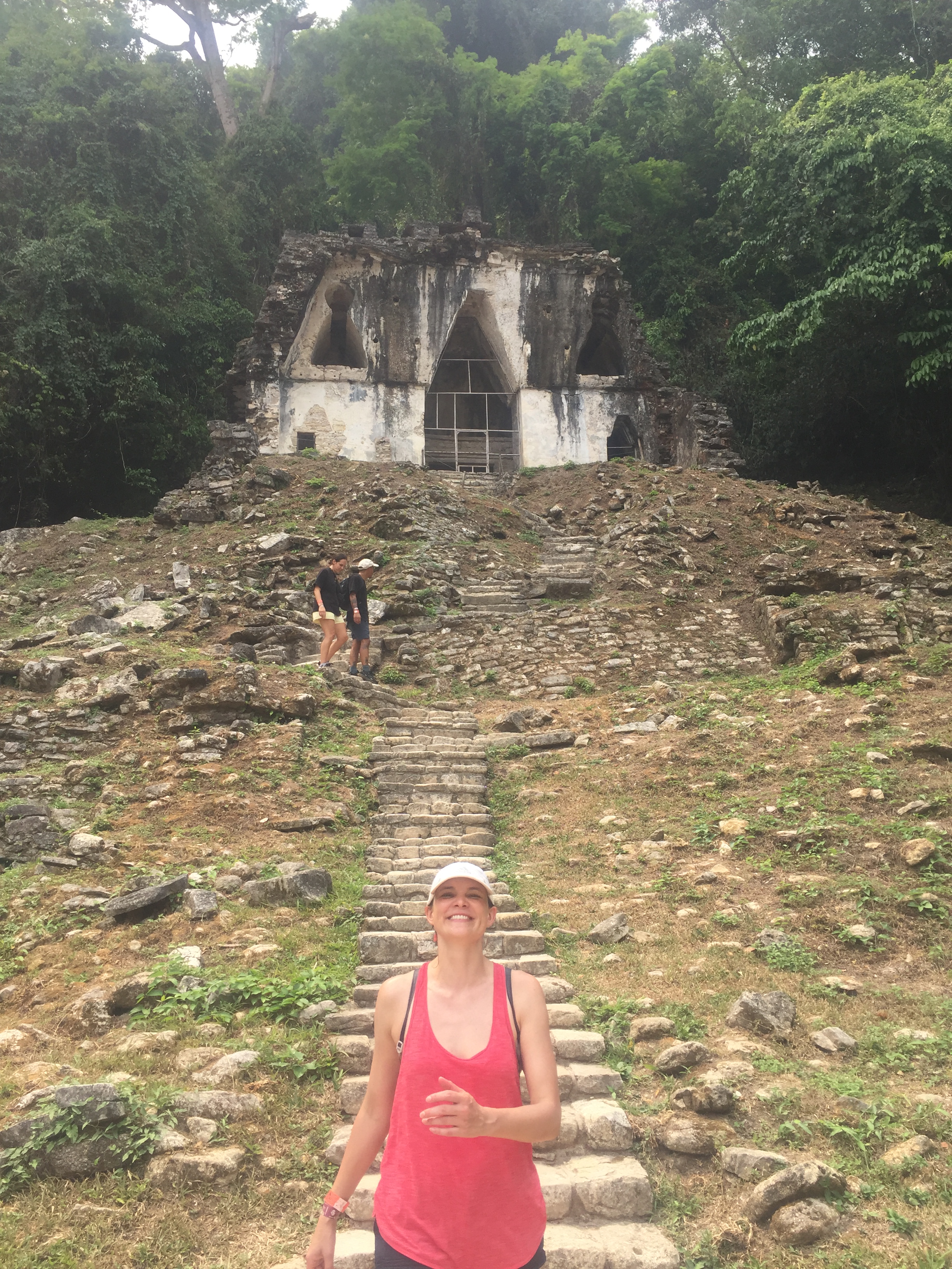
The first morning we set off walking up the jungle road to a supposed jungle trail we were told didn’t need a guide to show us the way. This turned out to be the case and we dipped off the trail to explore bat filled tunnels in 1000 year old ruined buildings, now taken over by the jungle, the walls crumbled and covered in earth.
Everywhere you look there are mounds of earth and rock where temples and houses once stood. Spiders, iguanas and other lizards scuttled out of the way while we explored.
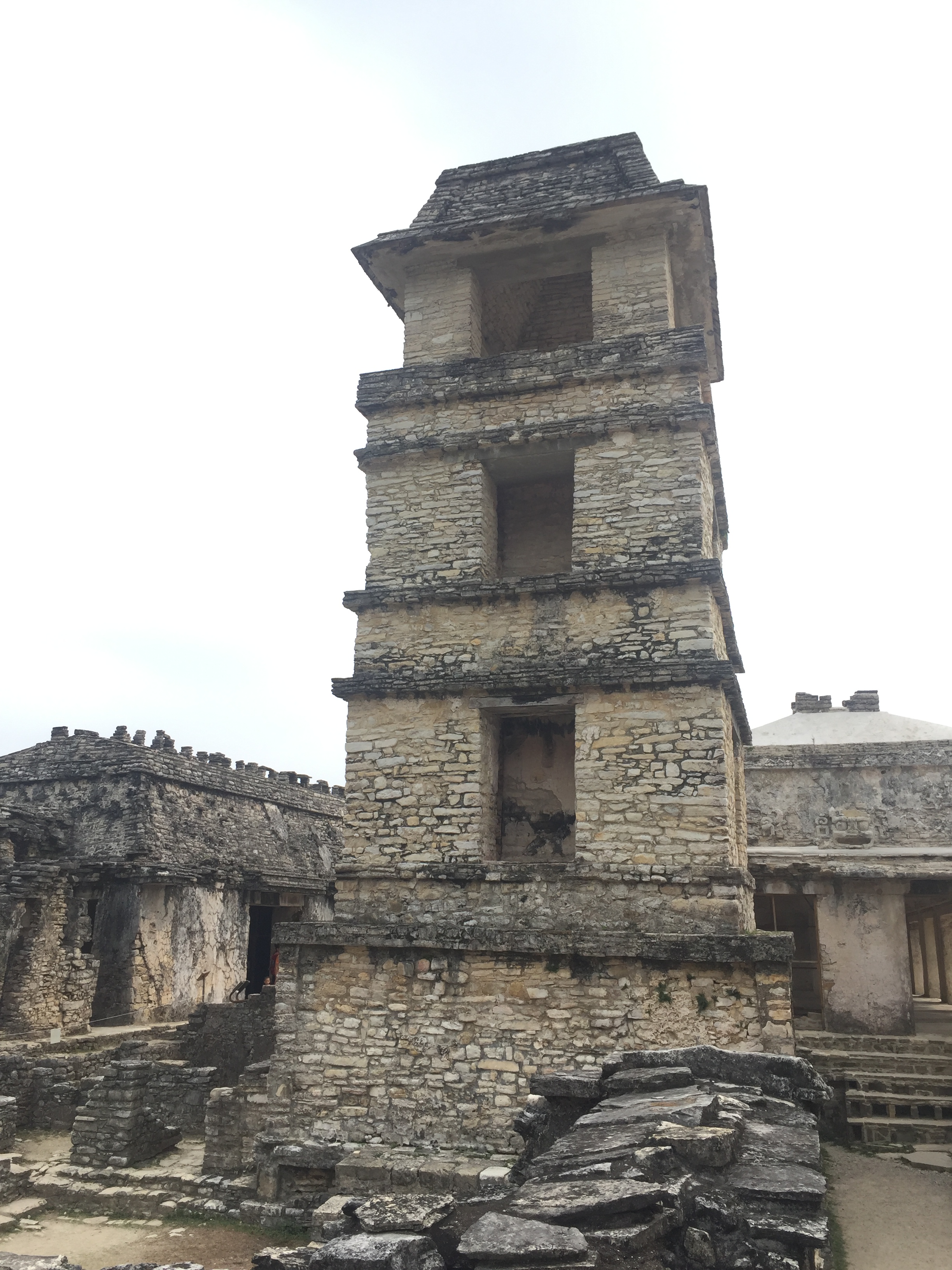
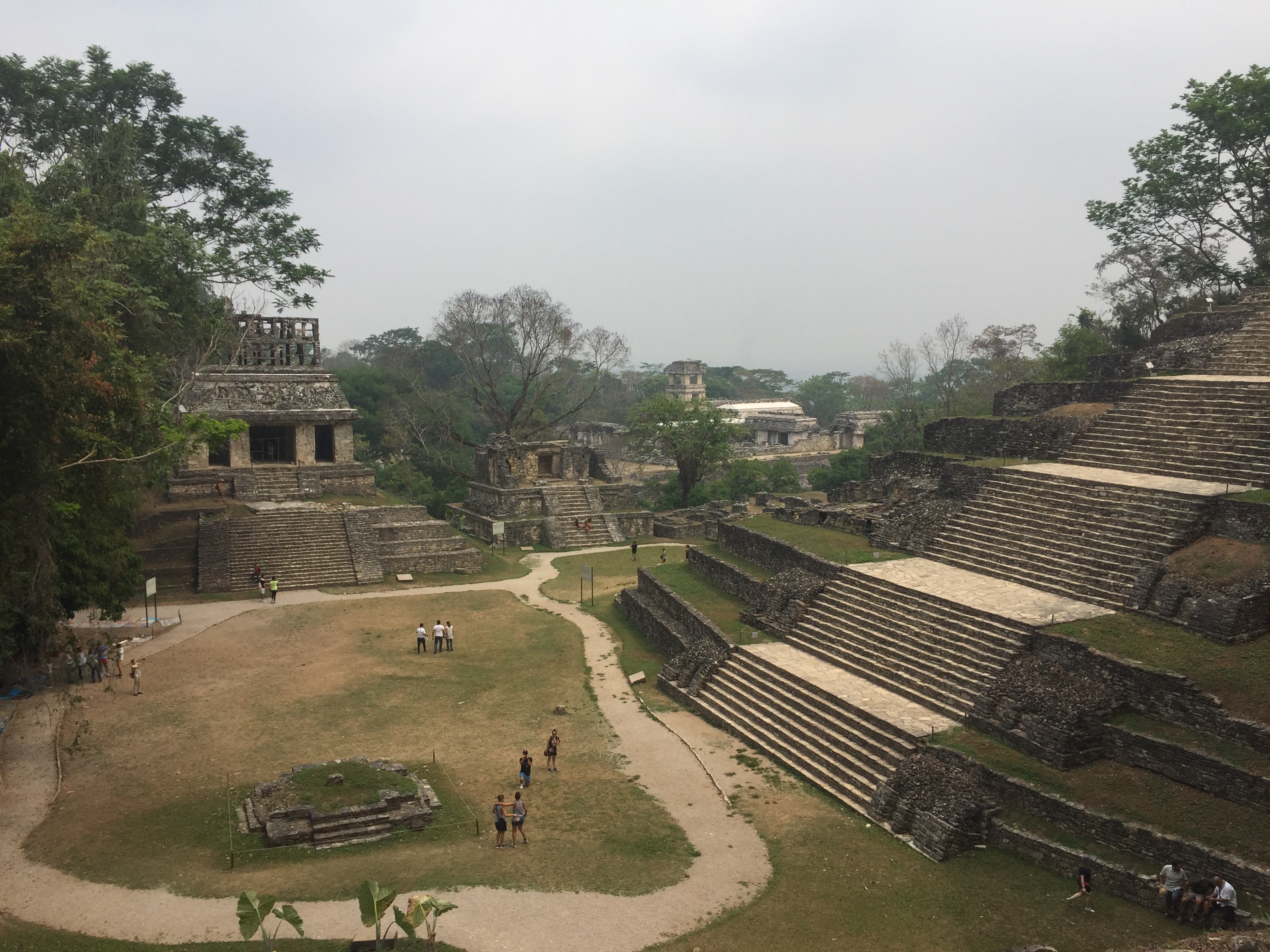
After this we arrived in the renovated ruins of Palenque. These have been painstakingly excavated and restored in parts. Only 10% of the city has been fully explored and studied. Most of the site looks like the above photo but the restored parts of the city show its glory in the 7th century.
We had the run of the place and walked around exploring and climbing most of the larger pyramids with our Aussie friends Becca and Jam. By the time we had reached the streams we were hot and bothered and ready for the pool and an ice cold beer.
The next day we jumped on board a local bus and headed towards the Guatemalan border to another Mayan site, one that Jen has always wanted to visit called Bonampak. A smaller site that is famous for some murals that are in pristine condition.
After dealing with a painfully long tour to visit the Canyon of Sumidero, we took our own route via public transport to hopefully avoid other tourists and their scheduled though would mean it costing just as much if not more to get there under our own steam. The combi bus flew alongside the jungle on one side, hurtling over speed bumps and through towns and eventually pulled up at the junction to Bonampak.
The site is 14km deep inside the jungle. In order to arrive we had to hire a local in his car for a couple of hours to take us there and wait for us while we explored the ruins. Antonio took us to a surprisingly small site whose almost run down facilities were quite surprising considering the fame the ruins and its murals have.
The souvenir sellers only budged slightly in their hammocks as we walked past, much more used to groups of 15 plus people arriving in mini buses. Staff weren’t at the entrance to the murals and they had to come out especially for us! We were literally the only two visitors in the entire site.
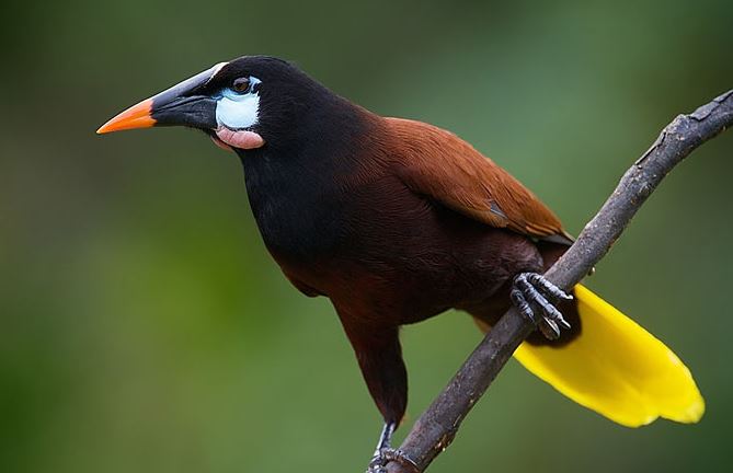
We shared it with a tree full of Oropendola birds. They have my favourite call of all birds, Something that really has to be heard! Their nests are crazy and amazing too. It reminded me of Belize and hearing several of these birds at once is quite the experience.
Montezuma Oropendola The call of the Montezuma Oropendola
After marveling at the birds, we checked out the murals and were suitably impressed by their clarity considering they were painted around the 6th century. They show lots of day to day life for Mayan people and also sacrifices.
After some suitable chin touching and pyramid climbing, we stuffed ourselves with La Vache Qui Rit and headed back to Palenque the way we came, only stopping briefly for the Guatemalan men to be pulled off the bus and frisked before our onward journey. We were heading to Tabasco the next day.