Up to the Blue

IMG_0424.jpeg
Blue Glacier, Olympic National Park

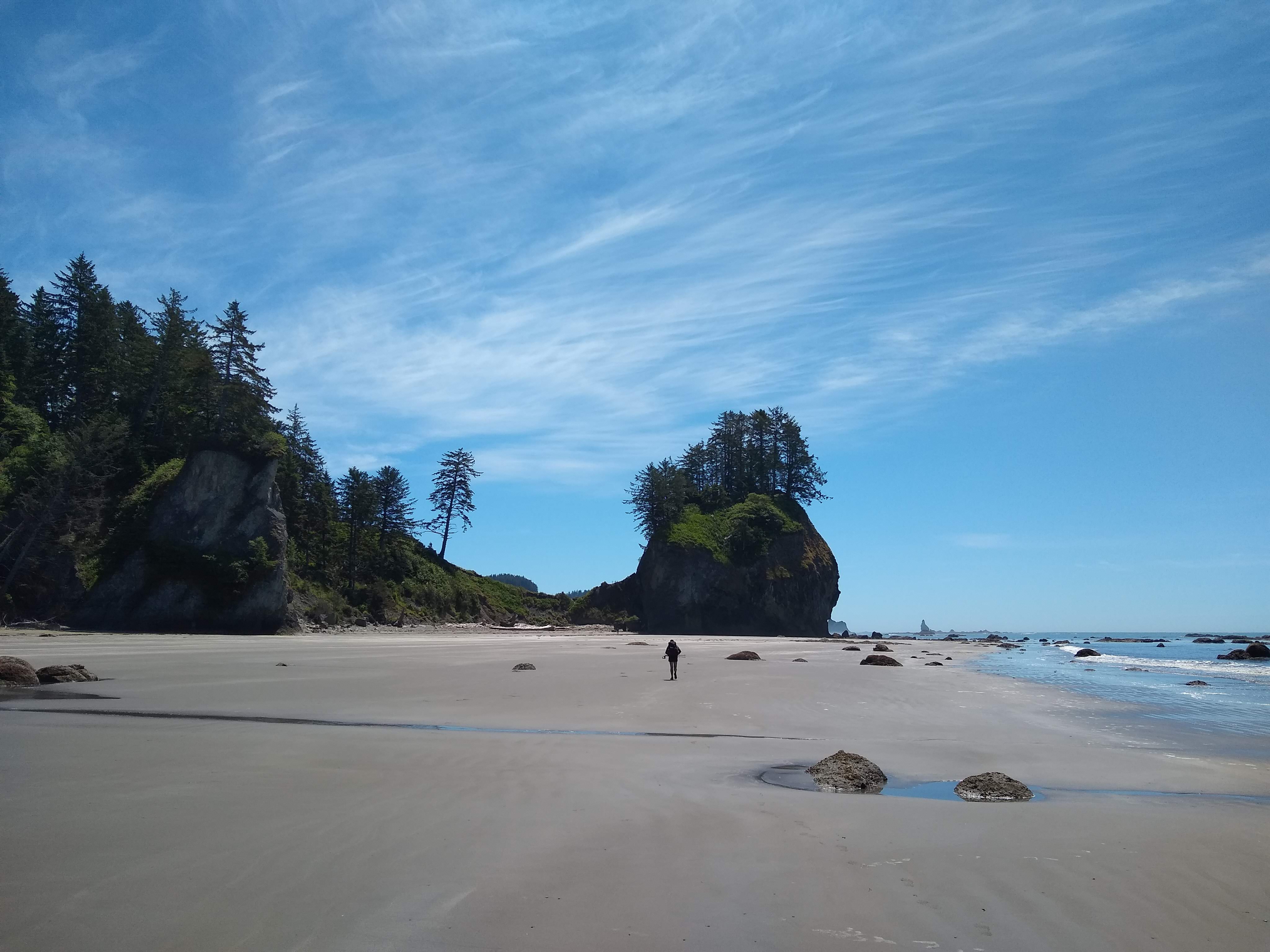
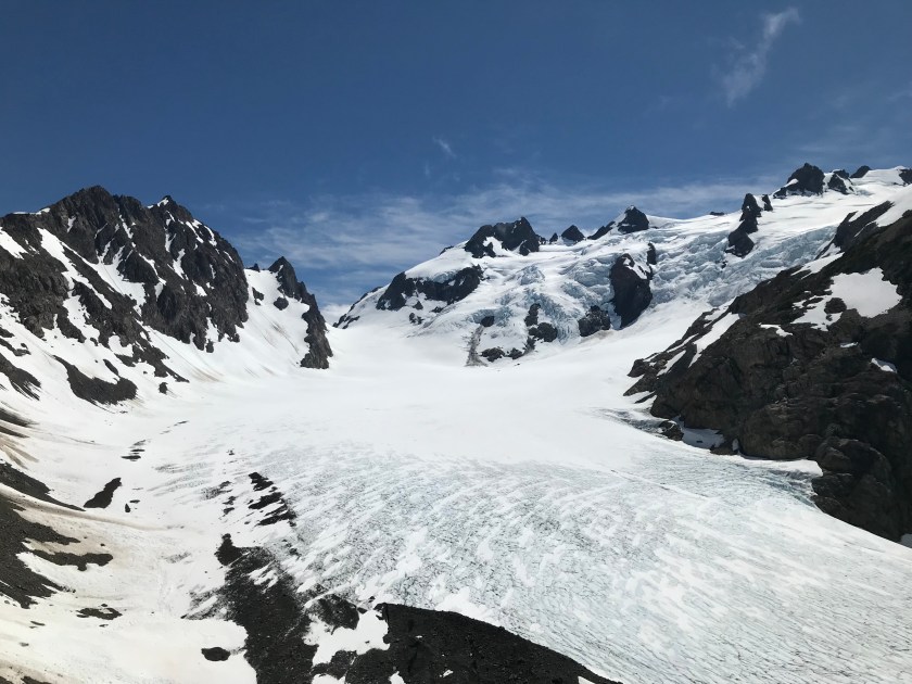
I’ve seen glaciers before and even walked on one. But the Blue Glacier in the Olympic National Park dazzled me.


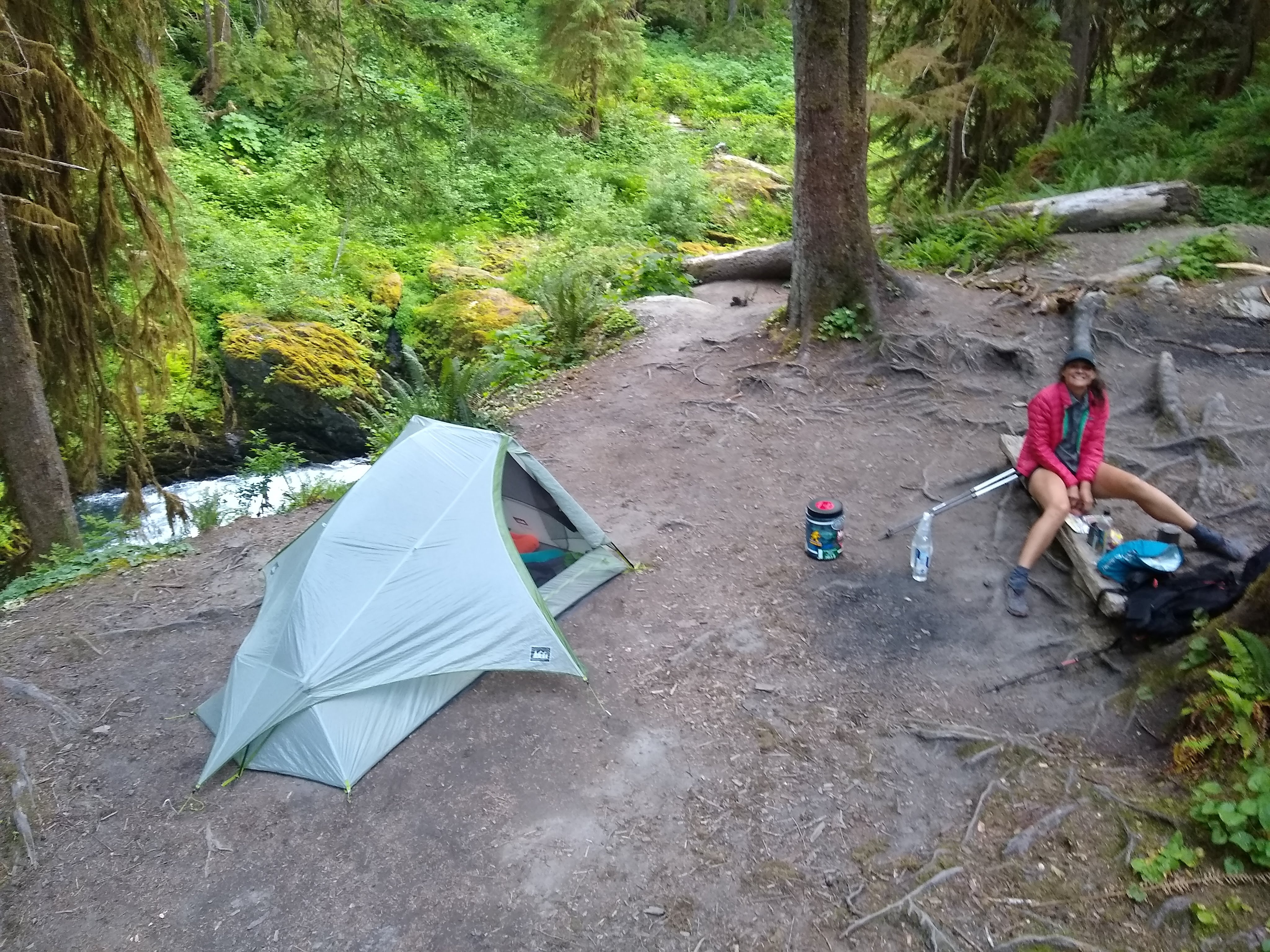
It was a soaring end to a day that started out low. When we planned the trip to the Olympics, we had planned to camp along the Hoh River at Lewis Meadow one night, then hike to the glacier and come back to stay again at Lewis Meadow the next night. Leaving our tent would allow us to travel more quickly up to the glacier. But Jake woke up in Lewis Meadow with a blister still throbbing from the previous day’s hike. He needed to stay in camp and rest. I didn’t want to go without Jake, but I also knew I would get stir-crazy in camp. I decided I would try to see how far I could go up the trail.

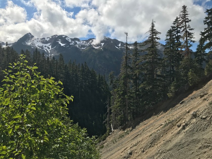
I quickly packed snacks and lunch and started out. The first couple of miles followed the the Hoh River. The trail was fairly flat. Deep in the rain forest, ancient trees were draped with hanging mosses. Even on a sunny day, the air felt thick with humidity. Then I turned a corner, and the switchbacks started. Over the next six miles, the trail gained 4,300 feet of elevation. My legs burned, but I stopped only to filter water and grab quick snacks. I had started out late and wanted to make it back to camp before dark.

UNADJUSTEDNONRAW_thumb_154fc.jpg
Elk Lake at 2,670 feet of elevation, 4.6 miles into the hike

At one point on a rocky bit of exposed trail I came across two men chatting. Both had separately reached the glacier earlier in the day and were comparing notes. I chatted with them for a moment, lauding the good weather and groaning about the switchbacks.

“Did you hear about the ladder?” one of them asked me.

I vaguely remembered a ranger telling us about some “ladder” when we picked up our permits. That was before the coast and Enchanted Valley. It seemed like a lifetime ago.

“The trail was washed out by a landslide, and there’s a ladder,” the man said. “Follow the purple rope. Then follow the cairns.”

I think I looked a little worse for wear because, as I left, the man shouted after me, “If I can do it, you can do it!”

A few hundred feet later, the trail just… stopped. Instead I saw what looked like a crumbling cliff. I saw a rope, but it was not purple! I panicked for a moment. Did I miss a turn off? Was this a different trail? 

UNADJUSTEDNONRAW_thumb_15547.jpg
Rope ladder down a section of washed out trail

Looking down, all I saw were rickety slabs of wood mounted on a wire. This was the famous ladder? This ladder didn’t go up, but instead it went down! I looked around for a moment to see if there was some other option. There wasn’t.

If I can do it, you can do it. The man’s words came back to me.

I inched my way out on the crumbly cliff and grabbed on to the only rope I could see. Hanging there, I examined the rope. It was an orange color with specks of pink. Still, it was not purple. But, again, there was nowhere else to go. Trembling, I edged my way down the ladder. Just when I thought I had gotten the hang of it, I came across a section with a missing rung and a couple of broken ones. I had to balance on the ends of them, shifting my weight and trying not to slip off. After what seemed like an eternity, I neared the end of the ladder.

And what did I find? A purple rope! It led off in a different direction. I shimmied over to that rope, and I was glad I did because it sent me to the spot where the trail resumed. I held on for dear life as I shuffled down the still-crumbling cliff. Then I followed the cairns.

Trails can be tough. Switchbacks can be brutal. But you’ll never know how grateful you are for switchbacks until there are none.

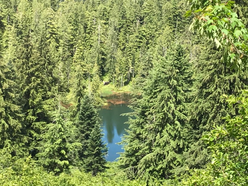
I took a few moments to rest and snack. Then I continued trudging up to Glacier Meadows. I love alpine meadows, and the ones below the Blue Glacier are no exception. The summer flowers were in bloom. There were so many colors and kinds! It was the perfect garden, and it sprung up without tending or weed-eaters.

IMG_0400.jpeg
Glacier Meadows

The trail continued up steeply through a couple of snow patches. Scurrying over the snow, I saw one of my favorite mammals: a pika. These tiny, adorable creatures are highly susceptible to climate change. They always remind me how important it is to preserve wild places.

After scrambling over rocks and boulders, I came over a rise and there it was: The Blue Glacier sparkling in the sun. I couldn’t help but exclaim when I saw it in front of me. It was so blue! It spread out from the lateral moraine where I stood. The snow-capped ice cascaded down. The glacier moved so slowly, it was imperceptible. But it moved with such power. Giant boulders were carried in its flow. I saw crevasses and ice towers.

All I could do was marvel at this soaring end to a stunning trail.

Enchanted Valley – PCT warm up/shake down

After a night in a “cheap” motel in Forks and plenty of town food and hygiene, we hopped on board the 50 cents bus to Amanda Park via the Hoh Indian Reservation and then hitched up to Graves Creek Trailhead with a Colombian family whose friends happen to be hiking NOBO this year: Lupine and Happy Bear. Anyone got a picture of them? It would be cool to see them as we sail past each other in Oregon, high fiving with a picture to send our friends who drove 25 miles out of their way to drop us near the trailhead.

We started a little late and smashed out the 13.5 miles up to Enchanted Valley in about 7 hours. It was very easy terrain and we’re far from going at thru hiking speeds yet, yet it felt great to do some decent miles with a full pack on without the interruption of seaweed covered rocks to slow us down. Our (mainly my) feet were still sore from a long road walk the previous morning but we were feeling stronger than before.

Lots of lovely trail in the Quinault River valley

The Enchanted Valley is a truly beautiful spot. A ranger station is inside a huge building on the edge of the Quinault River and checks everyone’s permits coming in to camp. It was a busy Father’s Day weekend so quite a few people were camped out, but the camping area is huge and there’s plenty of space so we felt like it was our own.

The view was stunning, and for the first time in quite a long time I had huge mountains in my face towering over us. Streams crashed down the peaks above us in almost continuous skinny waterfalls. I’d secretly packed out a liter of wine and surprised Jen with it at the camp fire. We slept for almost 12 hours that night, full and tipsy and rose later than most to enjoy our breakfast and lunch in grassy meadows below the majestic view.

Enchanted Valley view from near the camp ground with the ranger station

Wishing we had reserved two nights on our permits to enjoy the valley more, we walked back out to camp at Pony Bridge. Gliding past a big herd of what I initially thought was deer, then as I wondered why they were so big and ugly, realized they were in fact, elk. We got down to Pony Bridge and camped just above a deep gorge. My photography skills don’t do it justice, but here it is:

We got out very early the next day, had a slow and road walky hitch and headed over to the Hoh Rainforest to hike up to the Blue Glacier. Getting some biscuits and gravy first. Obviously.

Olympic National Park – Wilderness Coast – PCT Warm up/Shake down

Once I got to Seattle I was glad to hang out with a good friend there I know from Mexico City for a few hours. He hooked me up with a place to crash as I got in so late. We visited REI the next morning and got some great biscuits and gravy at Five Points Cafe. After a stroll down 3rd that made the Denver addicts look like amateurs, I said cheerio to Grant and headed off to Amtrak to meet Jen and her mum on their way back from Portland.

Once we got to Samish Island, we spent the evening eating, catching up chatting planning and packing before our short night’s sleep. The next morning we took a ferry to Port Townsend. It was a short trip across the water but we could see the mountains of the Olympic National Park across the way and suddenly everything felt quite real. This adventure was actually going to happen!

We spent the next several hours traveling bus to bus along the northern Olympic coast, stopping via the Wilderness Information Center and got our passes and information from ranger Brenden.

As soon as we arrived in Neah Bay, a guy from the Makah Reservation stopped in his pickup and offered us a lift without us even sticking out our thumbs. We jumped in the back and he drove down the dusty road that diverted us around a small forest fire, stopping at key spots so we could take shots of the beaches an stacks from his pickup. He dropped us off at the Shi Shi beach trailhead (pronounced Shy Shy) seemingly pretty excited about the fact that I was English shouting to some other hikers “He’s English!” and in return the Russians shouted less enthusiastically that they were Russian.

Our first hitch this summer from the pickup

We set up our tent on Shi Shi beach and we contemplated our coastal adventure of about 50 miles ahead, struggling to cook efficiently, being disorganized with our gear and feeling a bit untested in the outdoors. That’s what this trip was for though – let’s fudge this up and learn from it for the PCT.

Walking along Shi Shi

We settled down as a misty haze rolled in and the sun turned it a dark yellow during sunset. The next day we woke up to an overcast sky that burnt off in a couple of hours and glorious sunshine and beautiful views across the beaches came through. The forecast was basically the same for the next five days: glorious and hot. We looked at our maps and studied the tidetables for the 14th time and decided we had a nice relaxing 8 miles to our next campsite North of Ozette.

We headed off down Shi Shi and hit our first headland with ropes up the side of slopes way too dangerous to climb without this helping hand. We ascended and descended about three of these immense challenges on the first day. The last being the steepest and craziest, jumping off into a new environment. We settled down, feet and body sore and realized this wasn’t going to be a cake walk in the sun we had naively figured.

Jen dragging herself up a headland

The pattern of challenging but really enjoyable and fun days continued with gorgeous sunshine, making this normally wet and grey coast into something that could easily rival Mexico for beach beauty. Each part of the coast is distinct from the last: hard climbs over headlands using ropes, ups and downs to rival any part of the Appalachian Trail, hopping from seaweed covered rock to seaweed covered rock, soft gravel beaches where each step felt like three and easy hard yellow sand where you had to find the sweet spot of give and sink – just above the peak reach of the last wave.

The northern coast Wilderness Trail was hard, really hard at times. We successfully spent 24 days on vacation of beer and food and sightseeing and now my arse was getting kicked by the trail. My swollen Achilles kept badgering me but I was getting it under control with stretches and clearly I didn’t bring enough snacks.

Rocks and more rocks

We took it slow, getting used to the daily routine and doing each step slowly. Walking to get water and filtering it at a painfully slow rate. Washing up and not quite hitting the mark, doing it again. Trying to light a fire and having to start again. Each time things got a little easier and we laughed at our amateurish selves just hours before. Each day got more comfortable and our mileage increased a little. We started at around 8 miles a day and that increased steadily.

The Wilderness Coast is wild and has zero development. I hiked alongside a deer for a while, thousands of crabs dart away as we progressed, an otter came to see us at a water source before diving in two yards away, seals played in the waves next to the shore and we saw at least 50 eagles perching atop of trees and fishing in the ocean. There was even, unfortunately, a washed up and very bloated stinky whale on one beach that looked like it might explode. We had planned on camping right there, so carried on down wind not quite enjoying the aroma.

Further down the coast, we picked up a hitch from the very lovely Maureen and Kate who took us to a store and waited patiently for us before taking us to our trail head. Eventually reaching the end of our line at the Hoh Indian Reservation, after a grey and rainy day before, we were very ready for our motel room and cheeseburgers in Forks.

The next day, resupplied and laundered, we headed back to the trail, this time to the valleys and rainforests of the centre of the park.